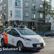
Beyond LiDAR: Approaches to improving the sensing capabilities of unmanned vehicles.
The LiDAR can sense the surrounding environment information in real-time and form high-definition 3D graphics. LiDAR works by emitting pulse-modulated light, observing the time difference between the reflected light and the emitted light to calculate distance, and by scanning or synchronously measuring multiple beams of light to obtain angle information. It has the advantages of fast response, long detection distance, and high accuracy, so it is the sensor solution with the highest measurement accuracy among the known environmental measurement solutions.
“LiDAR market size reached USD 1,821.3 Million in 2021 and is expected to register a CAGR of 12.5% during the forecast period and reach USD 5,299.2 Million in 2030, according to the latest analysis by Emergen Research. Increasing investment by different companies and research development (R&D) activities for LiDAR sensors is rising the market revenue growth. For instance, on 9 February 2022, Velodyne Lidar, a manufacturer of LiDAR sensors being used in self-driving cars, reported its stock rise of more than 60% in after-hours trading following regulatory filings.”
The LiDAR systems usually provide data at a refresh rate of 10Hz to 50Hz and can measure up to a range of 50m to 120m. The range data is considered the most accurate measurement of distance among existing sensors. A 2D LiDAR sensor with a two-dimensional laser beam is less expensive both in terms of purchasing price and computation capability requirements.
Especially when considering that a widely used typical 3D LiDAR, Velodyne HDL-64E, alone produces up to 75MB point cloud data every second and still needs to be processed in real-time, which would be a heavy burden for onboard systems and almost impossible for most the embedded systems.
In addition to that, even the most high-class and cutting-edge 3D LiDAR alone can not cover the entire surrounding area, which means there must be critical blind spots near the ego-vehicle that require supplementary sensory while still with accurate ranging. In particular, radars or ultrasonic radars produce inaccurate measurements that would downgrade the overall quality of fusion decision-making and may either cause unpredictable movements or false alarms.
During the course of the onboard LiDAR system, noise is inevitably included in the point cloud data obtained by the system due to factors such as acceleration, deceleration, change of driving direction, and so on. At present, most onboard LiDAR systems can provide the intensity information of the reflected pulse, which reflects the energy reflected from the target surface and is a reflection of the properties of different objects. But when the LiDAR systems, weather conditions, or other specific conditions are different, the intensity information reflected by the laser point cloud will also be very different.
Moreover, the onboard LiDAR point cloud data is a kind of blind data. The point cloud data is used as the spatial coordinate information of the surface of the object, and there is no information about the category to which the object belongs. This leads to great difficulties in the automatic recognition and feature extraction of objects such as buildings and human beings in the point cloud data.
LiDAR is too expensive to be used in mass production. There are two potential trends in the market, one is to reduce the cost of performance by producing LiDAR that can only accomplish a specific task with a limited detection distance; another is the use of solid-state LiDAR to reduce costs.

